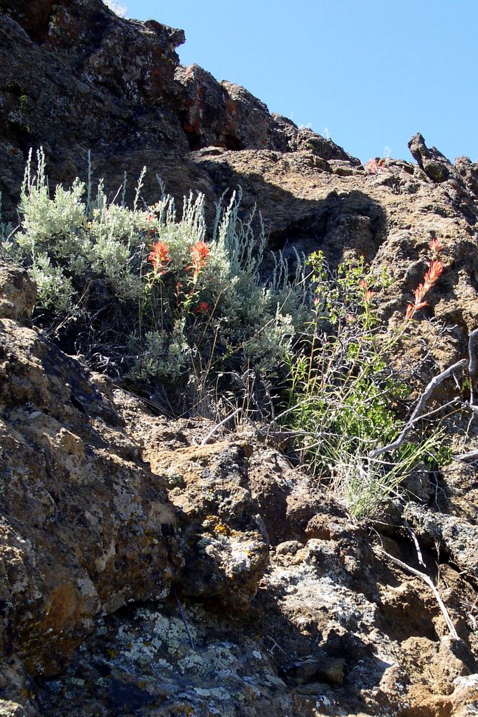
 This is a picture of the wildflowers currently growing in Fort Rock, outside of Fort Rock, Oregon (population maybe 30) until the heat kills them, probably tomorrow. Fort Rock is a volcanic formation that got worn down by an ice age lake to look like a, well, a fort. (I could get much more geological all over your ass, but I'll spare you. You can google it if you're as fascinated as I was.) I paid for this picture, for which I scaled the side of the fort, with a bruise the size of a grapefruit. Yes, there were wildflowers on the ground level. That wasn't the point.
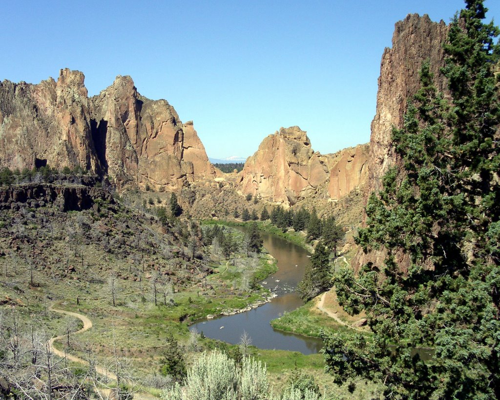 This is Smith Rocks outside of Terrebonne, Oregon (population maybe 1,000). We hiked to the top, crossed over to the other side and hiked down. It kicked ass. A postcard view from every angle. Smith Rocks is world renowned as a rock climbing destination. Even on a Tuesday there must have been two dozen climbing groups, none within hollering distance of the other there are so many places to climb. If you're into that kind of thing. Seems kind of silly when there is a perfectly good hiking trail to the top.
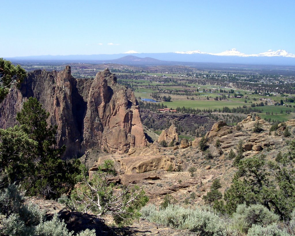 This is one of the views from the top of Smith Rocks. Cascade mountains in the distance.
 This is Storm Saxon in the world non-famous geological-slash-hiking-slash-partying-in-a-cool-place-on-a-hot-day destination Crack In The Ground. Yes, that is its proper name, located outside of Christmas Valley, Oregon (population maybe 500), and it also kicks ass. It's like a big fissure in the ground (insert more geological stuff here) that you can hike along for maybe a mile. You used to be able to go further, but the rocks continue to fall into the crack, obstructing the route. In a state not quite so packed with scenery, this would be a major attraction. In Oregon, we had to ask directions and follow a rutted dirt road and then assume that the wide spot in the road with the outhouse nearby was the trail head. Yes - we had the place to ourselves. But surprisingly, by the time we hiked out, there were two other vehicles pulling up. Guess the secret's out now.
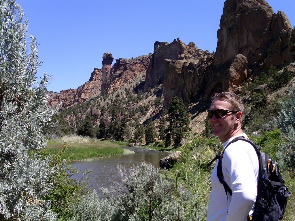 Here's the Captain pretending his knee doesn't hurt as we follow Crooked River back to the trail head after hiking up and down Smith Rocks. You can just see Monkey Face rock pillar in the background.
Not pictured here:
- Kayaking on the Deschutes River. Rocked.
- Meeting the folks at the Lava Cast Forest (that's where lava flowed into a forest, ate the trees in its fiery belly, but left impressions of them after it cooled). More geology and postcard views.
- Hiking past the Balancing Rocks (which we needed directions to, as it is another well-kept secret, mainly for keeping the yahoos from using them for target practice), finding other, double-secret balancing rocks, and finally finding the real balancing rocks on the way back.
- Tootling around Sunriver Resort, north of Bend, Oregon (population growing too fast to count) on bikes and feet.
- Birthday champagne, chocolates and risotto.
I'm so relaxed it will take me weeks to get my snarky back on.


2 comments:
nice glasses cap.. ya big nerd.
Didn't anyone notice that I used the words "ass" and "fissure" while describing a place called Crack In The Ground?
Post a Comment